ⴰⴼⴰⵢⵍⵓ:Algeria - Location Map (2013) - DZA - UNOCHA.svg

ⴰⴼⴰⵢⵍⵓ ⴰⵙⴰⵍⴰⵏ (ⴰⴼⴰⵢⵍⵓ SVG, ⵙ 254 × 254 ⵉⴷ ⴱⵉⴽⵙⵍ, ⵜⵉⴷⴷⵉ ⵏ ⵓⴼⴰⵢⵍⵓ: 345 KB)

ⵔⴰⵔ ⵜⴰⵡⵍⴰⴼⵜ ⴰⴷ ⵙ .

ⵉⴽⴽⴰ ⴷ ⵓⴼⴰⵢⵍⵓ ⴰ Wikimedia Commons. ⵉⵖⵢ ⴰⴷ ⵉⵜⵜⵓⵙⵎⵔⵙ ⴳ ⵉⵙⵏⴼⴰⵔⵏ ⵢⴰⴹⵏⵉⵏ. ⵢⵓⵎⵏ ⵓⴳⵍⴰⵎ ⴳ ⵜⴰⵙⵏⴰ ⵏ ⵓⴳⵍⴰⵎ ⵏ ⵓⴼⴰⵢⵍⵓ ⴳ ⴷⴷⴰⵡ ⴷⴰ.

ⴰⵙⴳⵣⵍ

ⴰⴳⵍⴰⵎ
Català: Mapa de localització d'Algèria.
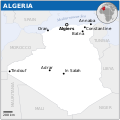
English: Locator map of Algeria.
ⴰⵙⴰⴽⵓⴷ
ⴰⵙⴰⴳⵎ
English: Algeria Locator Map (ReliefWeb), ESRI, UNCS
ⴰⵎⴳⴰⵢ
Other versions
SVG genesis
InfoField
 
The SVG code is valid.
 
This map was created with Inkscape.
 
 This map uses embedded text that can be easily translated using a text editor.
Translate this file This SVG file contains embedded text that can be translated into your language, using any capable SVG editor, text editor or the SVG Translate tool. For more information see: About translating SVG files.
This file is translated using SVG <switch> elements. All translations are stored in the same file! Learn more.

For most Wikipedia projects, you can embed the file normally (without a lang parameter). The Wikipedia will use its language if the SVG file supports that language. For example, the German Wikipedia will use German if the SVG file has German. To embed this file in a particular language use the lang parameter with the appropriate language code, e.g. [[File:Algeria - Location Map (2013) - DZA - UNOCHA.svg|lang=en]] for the English version. Do not specify a lang parameter if it is not needed. The parameter may prevent the use of a subsequent translation.

To translate the text into your language, you can use the SVG Translate tool. Alternatively, you can download the file to your computer, add your translations using whatever software you're familiar with, and re-upload it with the same name. You will find help in Graphics Lab if you're not sure how to do this.

ⵜⵓⵔⴰⴳⵜ

w:en:Creative Commons
ⴰⵎⴰⵙ
This file is licensed under the Creative Commons Attribution 3.0 Unported license.
ⵜⵉⵡⵓⵔⵉⵡⵉⵏ: OCHA
ⵜⴳⵉⴷ ⵉⵍⴻⵍⵍⵉ:
  • ⴱⴹⵓ – ⵉ ⵓⵙⵙⵏⵖⵍ, ⴰⴱⵟⵟⵓ ⴷ ⵓⵙⵎⵓⵜⵜⵢ ⵏ ⵜⵡⵓⵔⵉ
  • ⵛⵛⴰⵔ – ⵉ ⵓⵙⵎⵙⴰⵙⴰ ⵏ ⵜⵡⵓⵔⵉ
ⴷⴷⴰⵡ ⵜⴼⴰⴷⵉⵡⵉⵏ ⴰⴷ:
  • ⴰⵎⴰⵙ – ⵉⵇⵇⴰⵏ ⴷ ⴰⴷ ⵜⴼⴽⴷ ⵓⵎⵍⴰⵏ ⵖⴼ ⵓⵎⴳⴰⵢ, ⵜⴼⴽⴷ ⴰⵙⵖⵏ ⵖⵔ ⵜⵓⵔⴰⴳⵜ, ⵜⵎⵍⴷ ⵎⴽ ⵜⵜⵓⵙⴽⴰⵔⵏ ⵉⵙⵏⴼⵍⵏ. ⵜⵣⴹⴰⵔⴷ ⴰⴷ ⵜⵙⴽⵔⴷ ⵎⴽ ⴰⴷ ⵙ ⵜⵖⴰⵔⴰⵙⵜ ⵏⵏⴰ ⴷ ⵢⵓⵙⴰⵏ, ⵎⴰⵛⴰ ⵓⵔ ⴷ ⵙ ⴽⵔⴰ ⵏ ⵜⵖⴰⵔⴰⵙⵜ ⵏⵏⴰ ⵉⵙⵙⵓⵎⴰⵔⵏ ⵎⴰⵙ ⴷ ⴰⵎⴳⴰⵢ ⵉⵎⵙⴰⵙⴰ ⴷⵉⴽ ⵏⵉⵖ ⴷ ⵓⵙⵙⵎⵔⵙ ⵏⵏⴽ.
This map is part of a collection of 216 free country maps, created by the UN Office for the Coordination of Humanitarian Affairs (OCHA), to be used in print, web or broadcast products.

The ReliefWeb Location Maps released here are maps that highlight a country, its capital, major populated places and the surrounding regions.

Attribution Requirements

Using the map without modifications: ensure that the sources and the disclaimer are below the map. Credit as follows: "Credit: OCHA".

For use with alteration: remove the OCHA logo and disclaimer following any modification to the map, but keep the data sources as mentioned below the map. Credit the modified map as follows: "Based on OCHA map". You are responsible for the content of your map.

We are keen to receive your feedback and hear how you used OCHA's maps. We would be grateful if you would notify us by e-mail and share your work with us.

UN Disclaimer
The designations employed and the presentation of material of this map do not imply the expression of any opinion whatsoever on the part of the Secretariat of the United Nations concerning the legal status of any country, territory, city or area or of its authorities or concerning the delimitation of its frontiers or boundaries.

Captions

Add a one-line explanation of what this file represents

Items portrayed in this file

depicts ⵜⴰⵏⴳⵍⵉⵣⵜ

copyright status ⵜⴰⵏⴳⵍⵉⵣⵜ

copyrighted ⵜⴰⵏⴳⵍⵉⵣⵜ

copyright license ⵜⴰⵏⴳⵍⵉⵣⵜ

media type ⵜⴰⵏⴳⵍⵉⵣⵜ

image/svg+xml

checksum ⵜⴰⵏⴳⵍⵉⵣⵜ

4e9506463362bdb7077016635dd664e01da5ab58

determination method or standard ⵜⴰⵏⴳⵍⵉⵣⵜ: SHA-1

data size ⵜⴰⵏⴳⵍⵉⵣⵜ

349720 byte

height ⵜⴰⵏⴳⵍⵉⵣⵜ

254 pixel

width ⵜⴰⵏⴳⵍⵉⵣⵜ

254 pixel

ⴰⵎⵣⵔⵓⵢ ⵏ ⵓⴼⴰⵢⵍⵓ

ⴽⵍⵉⴽⵉ ⵖⴼ ⵓⵙⴰⴽⵓⴷ/ⴰⴽⵓⴷ ⵃⵎⴰ ⴰⴷ ⵜⵙⴽⵏⴷ ⴰⴼⴰⵢⵍⵓ ⵎⴰⵏⵎⴽ ⴰⴷ ⵢⴰⴷⵍⵍⵉ ⵉⴳⴰ ⴳ ⵡⴰⴽⵓⴷ ⴰⵏⵏ.

ⴰⵙⴰⴽⵓⴷ/ⴰⴽⵓⴷⵜⴰⵡⵍⴰⴼⵜ ⵎⵥⵥⵉⵢⵏⵉⵎⵏⴰⴷⵏⴰⵏⵙⵙⵎⵔⵙⴰⵖⴼⴰⵡⴰⵍ
ⴰⵎⵉⵔⴰⵏ19:06, 4 ⴷⵓⵊⴰⵏⴱⵉⵔ 2024ⴰⵙⵎⵥⵉ ⵏ ⵜⵍⵇⵇⵎⵜ ⴳ 19:06, 4 ⴷⵓⵊⴰⵏⴱⵉⵔ 2024254 × 254 (345 KB)ManlleusFile uploaded using svgtranslate tool (https://svgtranslate.toolforge.org/). Added translation for ca.
01:33, 19 ⵏⵓⵡⴰⵏⴱⵉⵔ 2022ⴰⵙⵎⵥⵉ ⵏ ⵜⵍⵇⵇⵎⵜ ⴳ 01:33, 19 ⵏⵓⵡⴰⵏⴱⵉⵔ 2022254 × 254 (342 KB)Pengetik-AMFile uploaded using svgtranslate tool (https://svgtranslate.toolforge.org/). Added translation for id.
17:16, 1 ⵎⴰⵕⵚ 2021ⴰⵙⵎⵥⵉ ⵏ ⵜⵍⵇⵇⵎⵜ ⴳ 17:16, 1 ⵎⴰⵕⵚ 2021254 × 254 (340 KB)Trần Nguyễn Minh HuyFile uploaded using svgtranslate tool (https://svgtranslate.toolforge.org/). Added translation for vi.
16:47, 30 ⴽⵟⵓⴱⵕ 2014ⴰⵙⵎⵥⵉ ⵏ ⵜⵍⵇⵇⵎⵜ ⴳ 16:47, 30 ⴽⵟⵓⴱⵕ 2014254 × 254 (342 KB)Dyln1Removed watermark.
01:20, 21 ⵉⴱⵔⵉⵔ 2014ⴰⵙⵎⵥⵉ ⵏ ⵜⵍⵇⵇⵎⵜ ⴳ 01:20, 21 ⵉⴱⵔⵉⵔ 2014254 × 254 (385 KB)UN OCHA maps bot== {{int:filedesc}} == {{Information |description={{en|1=Locator map of Algeria.}} |date=2013 |source={{en|1=[http://reliefweb.int/map/algeria/algeria-location-map-2013 Algeria Locator Map (ReliefWeb)]}} |author={{en|1=[[w:en:United Na...

ⵜⴰⵙⵏⴰ ⴰⴷ ⵜⵙⵎⵔⵙ ⴰⴼⴰⵢⵍⵓ ⴰⴷ:

ⴰⵙⵎⵔⵙ ⴰⵖⵣⵓⵔⴰⵏ ⵏ ⵓⴼⴰⵢⵍⵓ

ⵉⵡⵉⴽⵉⵜⵏ ⴰⴷ ⵢⴰⴹⵏⵉⵏ ⴰⵔ ⵙⵙⵎⵔⵙⵏ ⴰⴼⴰⵢⵍⵓ ⴰⴷ:

ⵙⴽⵏ ⵓⴳⴳⴰⵔ ⵖⴼ ⵓⵙⵙⵎⵔⵙ ⴰⵎⴰⵜⴰⵢ ⵏ ⵓⴼⴰⵢⵍⵓ ⴰⴷ.

ⵎⵉⵜⴰⴷⴰⵜⴰ