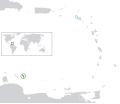
ⴰⴼⴰⵢⵍⵓ:BES islands location map.svg

Size of this PNG preview of this SVG file: 698 × 599 ⵉⴷ ⴱⵉⴽⵙⵍ. ⵓⴱⵓⵢⵏ ⵢⴰⴹⵏⵉⵏ: 280 × 240 ⵉⴷ ⴱⵉⴽⵙⵍ | 559 × 480 ⵉⴷ ⴱⵉⴽⵙⵍ | 894 × 768 ⵉⴷ ⴱⵉⴽⵙⵍ | 1 192 × 1 024 ⵉⴷ ⴱⵉⴽⵙⵍ | 2 385 × 2 048 ⵉⴷ ⴱⵉⴽⵙⵍ | 1 346 × 1 156 ⵉⴷ ⴱⵉⴽⵙⵍ.
ⴰⴼⴰⵢⵍⵓ ⴰⵙⴰⵍⴰⵏ (ⴰⴼⴰⵢⵍⵓ SVG, ⵙ 1 346 × 1 156 ⵉⴷ ⴱⵉⴽⵙⵍ, ⵜⵉⴷⴷⵉ ⵏ ⵓⴼⴰⵢⵍⵓ: 177 KB)
ⴰⵎⵣⵔⵓⵢ ⵏ ⵓⴼⴰⵢⵍⵓ
ⴽⵍⵉⴽⵉ ⵖⴼ ⵓⵙⴰⴽⵓⴷ/ⴰⴽⵓⴷ ⵃⵎⴰ ⴰⴷ ⵜⵙⴽⵏⴷ ⴰⴼⴰⵢⵍⵓ ⵎⴰⵏⵎⴽ ⴰⴷ ⵢⴰⴷⵍⵍⵉ ⵉⴳⴰ ⴳ ⵡⴰⴽⵓⴷ ⴰⵏⵏ.
| ⴰⵙⴰⴽⵓⴷ/ⴰⴽⵓⴷ | ⵜⴰⵡⵍⴰⴼⵜ ⵎⵥⵥⵉⵢⵏ | ⵉⵎⵏⴰⴷⵏ | ⴰⵏⵙⵙⵎⵔⵙ | ⴰⵖⴼⴰⵡⴰⵍ | |
|---|---|---|---|---|---|
| ⴰⵎⵉⵔⴰⵏ | 17:21, 27 ⵢⵓⵏⵢⵓ 2011 |  | 1 346 × 1 156 (177 KB) | Thayts | Strokes tweak |
| 20:32, 7 ⵎⴰⵕⵚ 2011 |  | 1 346 × 1 156 (177 KB) | Thayts | Strokes tweak | |
| 16:58, 6 ⵎⴰⵕⵚ 2011 |  | 1 346 × 1 156 (177 KB) | Thayts | Strokes tweak | |
| 16:31, 6 ⵎⴰⵕⵚ 2011 |  | 1 346 × 1 156 (177 KB) | Thayts | Darker gray | |
| 13:54, 6 ⵎⴰⵕⵚ 2011 |  | 1 346 × 1 156 (177 KB) | Thayts | Minor changes | |
| 21:55, 5 ⵎⴰⵕⵚ 2011 |  | 1 346 × 1 156 (214 KB) | Thayts | Minor changes | |
| 21:40, 5 ⵎⴰⵕⵚ 2011 |  | 1 346 × 1 156 (215 KB) | Thayts | Made circles darker for better visibility | |
| 21:32, 5 ⵎⴰⵕⵚ 2011 |  | 1 346 × 1 156 (215 KB) | Thayts | {{Information |Description={{en|Location map of the BES islands in the Lesser Antilles}} Equirectangular projection, N/S stretching 103 %. Geographic limits of the map: * N: 19.2° N * S: 9.7° N * W: 70.5° W * |
ⴰⵙⵎⵔⵙ ⵏ ⵓⴼⴰⵢⵍⵓ
ⵜⴰⵙⵏⴰ ⴰⴷ ⵜⵙⵎⵔⵙ ⴰⴼⴰⵢⵍⵓ ⴰⴷ:
ⴰⵙⵎⵔⵙ ⴰⵖⵣⵓⵔⴰⵏ ⵏ ⵓⴼⴰⵢⵍⵓ
ⵉⵡⵉⴽⵉⵜⵏ ⴰⴷ ⵢⴰⴹⵏⵉⵏ ⴰⵔ ⵙⵙⵎⵔⵙⵏ ⴰⴼⴰⵢⵍⵓ ⴰⴷ:
- ⴰⵙⵎⵔⵙ ⴳ af.wikipedia.org
- ⴰⵙⵎⵔⵙ ⴳ ar.wikipedia.org
- ⴰⵙⵎⵔⵙ ⴳ arz.wikipedia.org
- ⴰⵙⵎⵔⵙ ⴳ awa.wikipedia.org
- ⴰⵙⵎⵔⵙ ⴳ azb.wikipedia.org
- ⴰⵙⵎⵔⵙ ⴳ az.wikipedia.org
- ⴰⵙⵎⵔⵙ ⴳ ban.wikipedia.org
- ⴰⵙⵎⵔⵙ ⴳ be.wikipedia.org
- ⴰⵙⵎⵔⵙ ⴳ bh.wikipedia.org
- ⴰⵙⵎⵔⵙ ⴳ blk.wikipedia.org
- ⴰⵙⵎⵔⵙ ⴳ bs.wikipedia.org
- ⴰⵙⵎⵔⵙ ⴳ ca.wikipedia.org
- ⴰⵙⵎⵔⵙ ⴳ ceb.wikipedia.org
- ⴰⵙⵎⵔⵙ ⴳ chy.wikipedia.org
- ⴰⵙⵎⵔⵙ ⴳ cs.wikipedia.org
- ⴰⵙⵎⵔⵙ ⴳ da.wikipedia.org
- ⴰⵙⵎⵔⵙ ⴳ de.wikipedia.org
- ⴰⵙⵎⵔⵙ ⴳ diq.wikipedia.org
- ⴰⵙⵎⵔⵙ ⴳ dtp.wikipedia.org
- ⴰⵙⵎⵔⵙ ⴳ el.wikipedia.org
- ⴰⵙⵎⵔⵙ ⴳ en.wikipedia.org
- ⴰⵙⵎⵔⵙ ⴳ en.wiktionary.org
- ⴰⵙⵎⵔⵙ ⴳ eo.wikipedia.org
- ⴰⵙⵎⵔⵙ ⴳ es.wikipedia.org
- ⴰⵙⵎⵔⵙ ⴳ fa.wikipedia.org
- ⴰⵙⵎⵔⵙ ⴳ fi.wikipedia.org
- ⴰⵙⵎⵔⵙ ⴳ fr.wikipedia.org
- ⴰⵙⵎⵔⵙ ⴳ fy.wikipedia.org
- ⴰⵙⵎⵔⵙ ⴳ ga.wikipedia.org
- ⴰⵙⵎⵔⵙ ⴳ gd.wiktionary.org
- ⴰⵙⵎⵔⵙ ⴳ gl.wikipedia.org
- ⴰⵙⵎⵔⵙ ⴳ he.wikipedia.org
- ⴰⵙⵎⵔⵙ ⴳ hi.wikipedia.org
- ⴰⵙⵎⵔⵙ ⴳ hr.wikipedia.org
- ⴰⵙⵎⵔⵙ ⴳ hu.wikipedia.org
- ⴰⵙⵎⵔⵙ ⴳ hy.wikipedia.org
- ⴰⵙⵎⵔⵙ ⴳ ia.wikipedia.org
ⵙⴽⵏ ⵓⴳⴳⴰⵔ ⵖⴼ ⵓⵙⵙⵎⵔⵙ ⴰⵎⴰⵜⴰⵢ ⵏ ⵓⴼⴰⵢⵍⵓ ⴰⴷ.